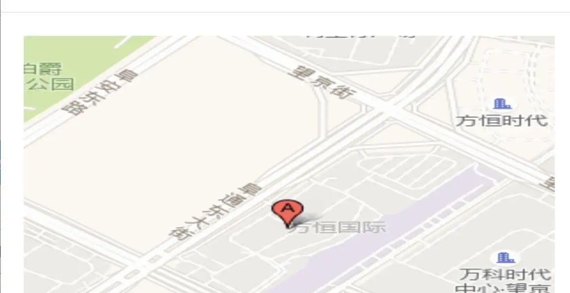
参考文档 https://lbs.amap.com/api/webservice/guide/api/staticmaps/
需求是, 通过经纬度坐标, 返回一个地图的标注图, 最后展示的是一个图片.
openGisDialog (record) {
            this.gisImgVisible = true;
            let gisImg = {
                mainKey:  gisUrl ,
                key: 你的key , //
                location:`${record.longitude},${record.latitude}`,
                zoom: 15 ,
                size: 600*400 ,
                scale:  2 ,
                markers:`-1,${record.modelImg},:${record.longitude},${record.latitude}`,
                gisUrl:  http://restapi.amap.com/v3/staticmap? ,
            }
            this.gisTitle = `${record.waterMode}[${record.waterSection}]`
            this.gisImgUrl = this.getGisImgUrl(gisImg)
        },
        getGisImgUrl (obj) {
            let url =
            let params = []
            for (let key in obj) {
                if (key === obj.mainKey) {
                    url = obj[key]
                } else if (key !==  mainKey ) {
                    params.push(`${key}=${obj[key]}`)
                }
            }
            url += params.join( & )
            return url
        },
© 版权声明
文章版权归作者所有,未经允许请勿转载。
相关文章


暂无评论...


![[理论篇-10]AI 工作流(AI Workflow)—— 让 AI 像流水线一样干活](https://www.dunling.com/img/1.jpg)